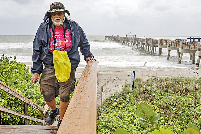
PORT SAINT LUCIE, USA: Dorian kills five in Bahamas, US evacuates SE coast
PORT SAINT LUCIE, United States (AFP) – Monster storm Dorian hovered over the Bahamas as surging seawaters and ferocious winds sowed chaos in low-lying island communities, killing at least five people and spurring mass evacuations on the US east coast. More details in Wednesday’s Borneo Bulletin.
ADS by Cloud 9:
.
– SPACE RESERVE FOR YOUR ADVERTISEMENT –

RELATED NEWS:
Deadly Hurricane Dorian pounds Bahamas, 5 dead
FREEPORT, Bahamas: Hurricane Dorian came to a catastrophic daylong halt over the northwest Bahamas, flooding the islands of Abaco and Grand Bahama with walls of water that lapped into the second floors of buildings, trapped people in attics and drowned the Grand Bahama airport under 6 feet of water.
At least five people died and 21 injured people were airlifted to the capital by the US Coast Guard, Bahamas officials said.
“We are in the midst of a historic tragedy,” Prime Minister Hubert Minnis said. “The devastation is unprecedented and extensive.”
Winds and rain continued to pound the northwest islands, sending people fleeing the floodwaters from one shelter to another.
ADS by Cloud 9:
.
– SPACE RESERVE FOR YOUR ADVERTISEMENT –


.
ADS by Cloud 9:
.
– SPACE RESERVE FOR YOUR ADVERTISEMENT –

By Tuesday morning, the storm’s top sustained winds had dipped to 193 kilometer per hour, making it a Category 3 hurricane, but it remained almost stationary. It was centered 40 kilometers northeast of Freeport — roughly the same distance from the city as at 9 a.m. Hurricane-force winds extended out as far as 75 kilometers in some directions.
ADS by Cloud 9:
.
– SPACE RESERVE FOR YOUR ADVERTISEMENT –

Hundreds of thousands of people in Florida, Georgia and South Carolina were ordered to evacuate before the storm rolls up the Eastern Seaboard, bringing the possibility of life-threatening storm-surge flooding even if the storm’s heart stays offshore, as forecast. Several large airports announced closures and many flights were cancelled for Monday and Tuesday.
The US Coast Guard airlifted at least 21 people injured on Abaco Island, which Dorian hit on Sunday with sustained winds of 295 kph and gusts up to 355 kph, a strength matched only by the Labor Day hurricane of 1935, before storms were named. Scientists say climate change generally has been fueling more powerful and wetter storms and the only recorded storm more powerful than Dorian was Hurricane Allen in 1980, with 305 kph winds, though it did not make landfall at that strength.
ADS by Cloud 9:
.
– SPACE RESERVE FOR YOUR ADVERTISEMENT –

Abaco and Grand Bahama, neither much more than 40 feet above sea level at their highest points, are home to some 70,000 people.
Bahamian officials said they received a “tremendous” number of calls from people in flooded homes. One radio station said it received more than 2,000 distress messages, including reports of a 5-month-old baby stranded on a roof and a woman with six grandchildren who cut a hole in a roof to escape rising floodwaters. At least two designated storm shelters flooded.
Dorian killed one person in Puerto Rico, at the start of its path through the Caribbean.
Minnis said many homes and buildings were severely damaged or destroyed, but it was too early to say how much the rebuilding effort would cost. Choppy brown floodwaters reached roofs and the top of palm trees on Monday.
ADS by Cloud 9:
.
– SPACE RESERVE FOR YOUR ADVERTISEMENT –

Parliament member Iram Lewis told The Associated Press his greatest fear was that waters would keep rising overnight and that stranded people would lose contact with officials as cellphone batteries died.
“It is scary,” he said, adding that Grand Bahama’s airport was 6 feet underwater and that people were moving shelters as floodwaters kept surging. “We’re definitely in dire straits.”
The US National Hurricane Center said Dorian was expected to start moving slowly to the west-northwest Tuesday while continuing to pound Grand Bahama Island into the morning.
The Center said the track would carry the storm “dangerously close to the Florida east coast late Tuesday through Wednesday evening and then move dangerously close to the Georgia and South Carolina coasts on Wednesday night and Thursday.”
While it was expected to stay offshore, meteorologist Daniel Brown cautioned that “only a small deviation” could draw the storm’s dangerous core toward land.
AP
ADS by Cloud 9:
.
– SPACE RESERVE FOR YOUR ADVERTISEMENT –


All photographs, news, editorials, opinions, information, data, others have been taken from the Internet..t..aseanews.net


