

UPDATE – Asean Weather Dec. 18-24 2017 : Typhoon Kaitak (Urduja)- ‘Urduja’ hits Palawan after battering Visayas
.
RELATED NEWS:
Urduja maintains strength ahead of northern Palawan landfall
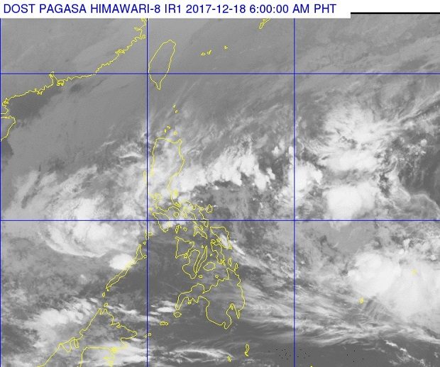
The clouds of tropical depression ‘Urduja’ appear to be thinning but remain potent as it crosses over to Palawan, where it was expected to make landfall Monday morning, Dec. 18, 2017. PAGASA PHOTO
.
.
MANILA, Philippines — Tropical depression Urduja has made landfall over Taytay, Palawan Monday morning after dumping heavy rain that caused floods and landslides in Eastern Visayas.
In a weather bulletin issued at 8:00 a.m., Pagasa said Urduja has maximum sustained winds of 55 kilometers per hour and gustiness of up to 90 kilometers per hour.
Only Palawan remains under signal number 1.
“Scattered rains will continue over Palawan. Residents of these areas must undertake appropriate measures against flooding and landslides and coordinate with their local disaster risk reduction and management offices,” Pagasa said.
The tropical depression is forecast to move west at 18 kilometers per hour and is expected to exit the Philippine Area of Responsibility between Tuesday morning and afternoon.
Urduja, which has been downgraded from a tropical storm, triggered floods and landslides which killed at least 26 people, Biliran Gov. Gerardo Espina said in an interview on ABS-CBN. At least 23 people are reported missing.
Meanwhile, the tropical depression outside the PAR has weakened into a low pressure area. It was located 1,630 kilometers east of Mindanao.
READ: LIST: Domestic flights canceled on December 18 due to ‘Urduja’
(philstar.com) | Updated December 18, 2017 – 9:27am
<>
‘Urduja’ changes track, moves towards Aklan Province, Philippines
Tropical Depression “Urduja” slightly changed track on Sunday, Dec. 17, a day after making landfall in Eastern Samar, and started moving west-southwest towards Aklan province.
In its 5 p.m. bulletin, the Philippine Atmospheric, Geophysical and Astronomical Services Administration (Pagasa) said Urduja at 15 kph.
<>
ADVERTISEMENT: This space is reserve for your Ad, contact aseanews.net now!
<>
It was last spotted at 65 km south of Romblon town in Romblon with a strength of 55 kph and a gustiness of up to 80 kph.
Typhoon Signal No. 1 remained raised over the following areas:
- southern part of Mindoro
- Romblon
- Palawan
- Aklan
- Antique
- Capiz
Pagasa warned of possible flooding and landslides as scattered to widespread rain were expected to prevail over those areas. /atm
COURTESY:
The Philippine Daily Inquirer
By: Faye Orellana
05:45 PM December 17, 2017
.
NOTE : All photographs, news, editorials, opinions, information, data, others have been taken from the Internet ..aseanews.net | [email protected] |
For comments, Email to :
Icarus d’ Greek | [email protected] | – Contributor