
HEADLINE | MANILA- Pagasa: Super typhoon Mawar (Betty) intensifies as it nears Philippine area of responsibility (PAR)
“Mawar”, which will be named Betty once it enters the country’s weather monitoring area, currently packs winds of up to 215 kph near the center and gusts of up to 265 kph as it moves at 20 kph west northwest.
.


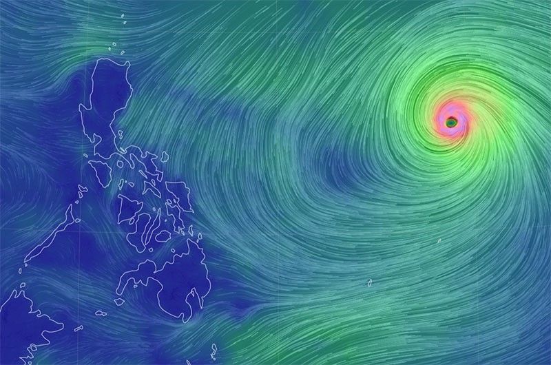
MANILA, Philippines — Super typhoon Mawar has further intensified over the Philippine Sea while swirling towards the Philippine area of responsibility (PAR), according to the Philippine Atmospheric, Geophysical and Astronomical Services Administration (Pagasa).
In its Thursday evening update, Pagasa, said “Mawar”, of 10:00 p.m. was spotted some 1.840 kilometers east of southeastern Luzon, with increased maximum sustained winds of from 195 kilometers per hour (kph) to 205 kph and gustiness of from 240 kph to 250 kph while moving west at 20 kph.
 Memento Maxima Digital Marketing
“Current forecast scenario shows that the typhoon may bring heavy rains (which may trigger flooding or rain-induced landslides) over Northern Luzon beginning late Sunday or on Monday next week. In addition, strong to storm-force conditions may be experienced over extreme Northern Luzon, while strong to gale-force conditions are possible over the northern and eastern portions of Northern Luzon mainland,” Pagasa warned.
“Mawar is also forecast to enhance the Southwest Monsoon which may bring monsoon rains over the western portions of Central Luzon, Southern Luzon, and Visayas beginning on Sunday or Monday,” the state weather bureau added.
The super typhoon is forecast to continue moving westward until Friday while accelerating before turning more west northwestward on Saturday, said Pagasa.

“On the track forecast, the super typhoon will enter the PAR tomorrow evening or on Saturday morning. Mawar will begin to decelerate on Sunday as it begins to move closer towards the waters east of extreme Northern Luzon. The center of Mawar’s eye is forecast to be within 300 kilometers of the Batanes-Babuyan archipelago by early next week during the slowdown period.”
…
LIFESAVERS ON ALERT In Manila, the city government on Thursday readies rescue units for the effects of Supertyphoon “Mawar,” which will also be known as “Betty” once it enters the Philippine Area of Responsibility either Friday night or Saturday morning. —MARIANNE BERMUDEZ
…
Once it enters the PAR, the typhoon will be given the local name “Betty.”
It would be the second storm to hit the country this year and the first this month.
 Ads by: Memento Maxima Digital Marketing
@[email protected]
SPACE RESERVE FOR ADVERTISTMENT
.